This is a study of the post marks used by the postmasters in what is now Alberta and Saskatchewan pre joining Confederation in 1905. This is presented by town, the hammers by date with the earliest recorded date and latest recorded date including photos of envelopes having these hammers.
History of the development of Alberta and Saskatchewan
In 1670 May 2nd the Hudson’s Bay Company was established and received a Royal Charter for the exclusive grant of all the territory surrounding all rivers draining the Hudson’s Bay. This vast territory sprawled north to the Arctic, east thru what is now northern Ontario and northern Quebec, south to Minnesota and west to the Rockies. This entire area became known as Rupert’s Land named for Prince Rupert , founder and the first governor of the Hudson’s Bay Co. Over the next 200 years a fur trade and exploration of the area evolved. In addition to using rivers, cart paths became important as there was a need to reach destinations not served by rivers. One of these was the Carleton Trail which ran from Fort Ellice in Manitoba, along the Qu’appelle river past Sumner to Fort Qu’appelle and up to Touchwood Hills and onto Humbolt and Fort Charleton. The trail continued to Fort Battleford and onto Fort Saskatchewan (Edmonton).
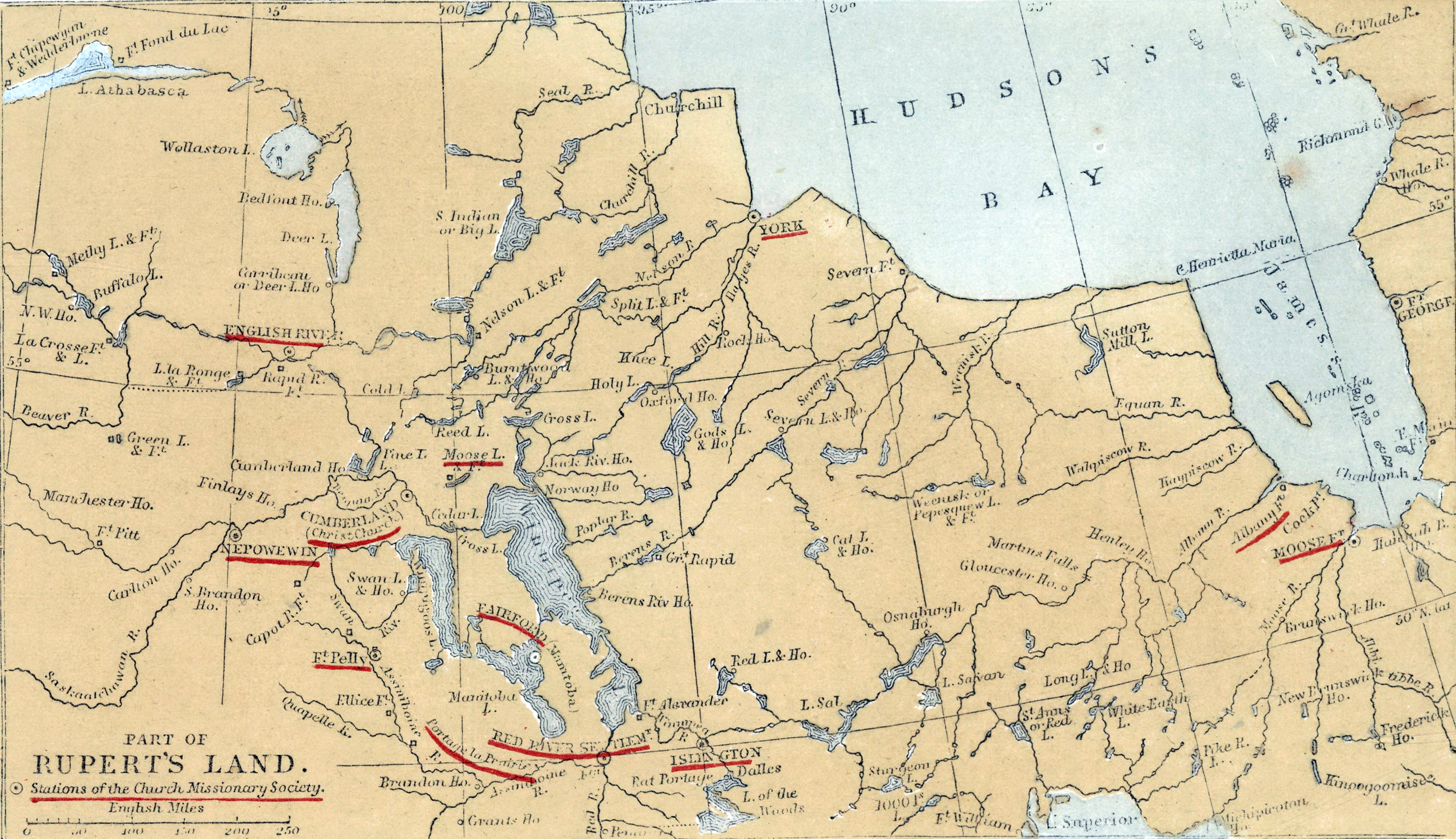
Part of Rupert's Land in 1862
In 1867 the Dominion of Canada was formed uniting Ontario, Quebec, Nova Scotia and New Brunswick.
The Imperial Act of 1868 and Imperial Order in Council dated June 23, 1870 transferred jurisdiction of the remaining Rupert’s Land from Hudson’s Bay Co to Canada and was named “North West Territory”. The original proposal suggesting that a new province consisting of all of the fertile belt between Winnipeg and British Columbia was rejected by the Canadian federal government as it conflicted with their plans to manage the settlement of the Northwest Territories directly. As a compromise, a small part of the district, consisting mainly of the settled areas, was admitted to Canada as the Province of Manitoba in 1870.
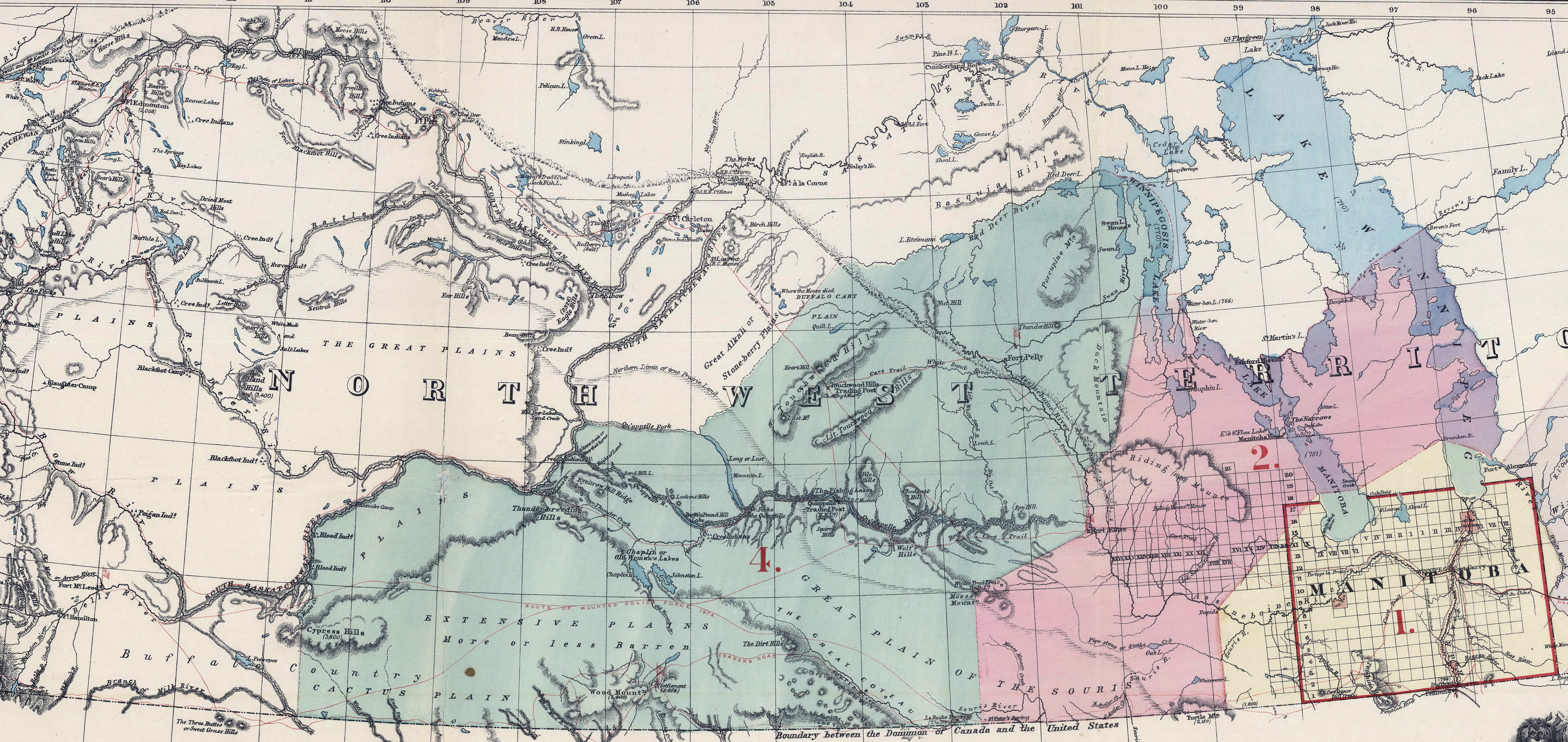
The North-West Territories in 1875
Postal service started as early as 1876 in the North-West Territories with the post mark of NWT. The first post office was opened in Livingstone effective on Aug 1, 1876 but closed September 30, 1879. There is no record of Livingstone on the Canada post office archives
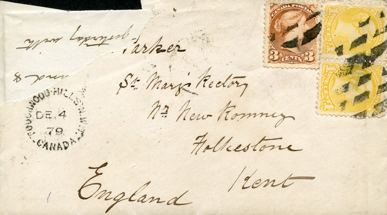
Touchwood Hills was a HBC trading post existing from 1879 to 1909
The post office was opened in Sept 8, 1879.
This envelope’s post mark is Dec 4, 1879 with Touchwood Hills NWT
In order to bring stability to the west and unite the country, the Government of Canada adopted the strategy of establishing a police force in the Northwest, building a railroad uniting British Columbia with central Canada and attracting settlers to the west. On February 15, 1881 a charter was granted to the Canadian Pacific Railway with the project to build a railway joining British Columbia to Winnipeg. With the building of the railway came settlers and the first post offices were built along the railway line. By spring of 1882, the railway had been completed to Indian Head and by Dec 1882, the line was completed to the future site of Maple Creek.
On December 1,1882 the Districts of Assiniboia, Saskatchewan and Alberta were formed for administrative and postal convenience from the southern portion of the North-West Territories. These districts continued until 1905 when Alberta and Saskatchewan joined Confederation Some post offices changed to hammers ASSA, ALTA and SASK but many continued to use NWT.
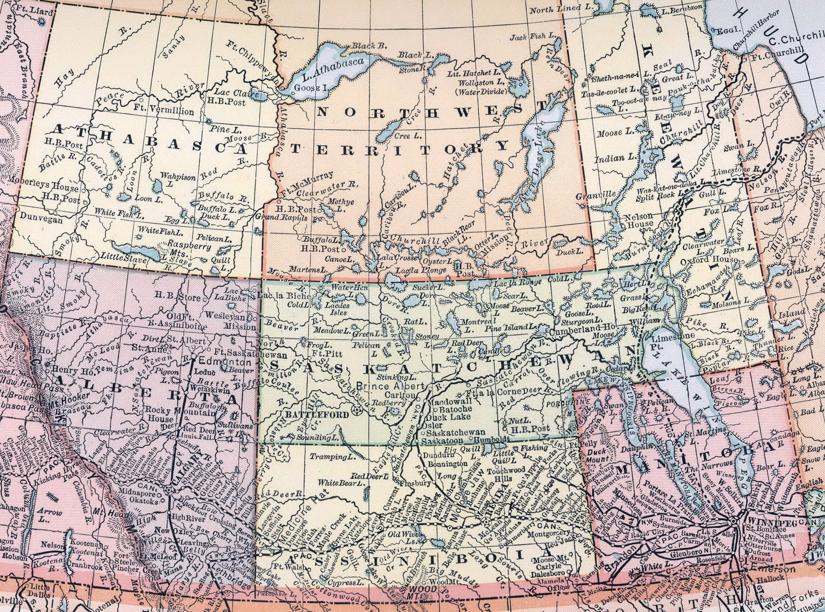
The territories in 1891